Lab Eight - Google Earth KML and 3-D spatio-temporal data
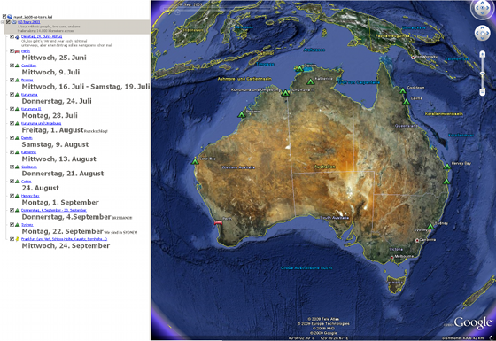
For this lab I took the recommendation to visualize a past trip with KML and decided to map the online diary (the term "blog" wasn't that common in those days...) of a trip around Australia I made in 2003 with a few friends. I left the text completely original so, no Umlaute, of course, and very interesting reading material especially for me that I probably wrote some of it and don't remember which entries :-). Sorry that the text is all in German though! The work was a lot of copy and paste from the original website, but I had to manually adapt the layout of the image tables (and the small images are still not clickable...). The symbols distinguish between camping and sleeping in a real bed.
This file was a long thought idea of mine, apart from the lab. The file today contains only the places (including date(s)) where we stayed and wrote an entry in the diary, I plan to map our driving route (I didn't study back then, so sadly no GPS tracks... wasn't a geek yet!) and all those little great sights and spots in between. I also made a few videos with my digital camera that I plan to embed in an extra layer. And hundreds of links to national park websites and backpackers et cetera. So come back in a few years (because that's quite some work to do).
Back to main page